 Write a comment
The mill race was a crucial part of Newry’s industrial past, channeling water to power mills.

Early maps, such as the Lythe Map of 1570, indicate the existence of watercourses outside the town walls that predate the mill race itself. These may have been used by Cistercian monks to irrigate orchards and gardens before the abbey’s dissolution in 1548. A dotted line on the map follows the path of the later Mill Race at least as far as Lower Water Street to a large body of water, with the note ‘These black pyrches does give us a very good plan for a mylne dame’. Despite these plans for a Mill dam, it is likely that a Mill race was built instead. Historian Peter Sinclair suggests that race was likely constructed in the late 16th century under Nicholas Bagenal’s direction. A 1588 grant from Nicholas and Henry Bagenal to Patrick Creely (Crilly) of Newry included land, two water mills, watercourses, and weirs on the Clanrye River. A 1612 inquisition records that Newry had two mills and two weirs—one for salmon and the other for eels—most likely situated in the Mill Street area.
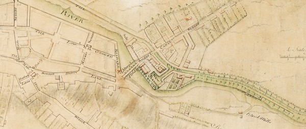
Maps from the 17th and 18th centuries provide further insights. A 1624 map of Carlingford Bay shows Mill Street, then a small settlement with about six to eight buildings. By 1703, the Neville Survey reveals an expanded Mill Street with around 10-12 buildings. This survey includes the earliest known depiction of the mill race, which ran from Trevor Hill to an area now known as O’Hagan Street where the race reconnects with the river. A building near the race in this survey is likely one of the original water mills referenced in the 1588 grant.
The 1760 Rocque Map illustrates the mill race winding through Newry, running alongside the river at Trevor Hill before disappearing and reappearing under various streets including Kildare Street, Margaret Street, Back Lane and Mill Lane (The latterly two becoming Water Street). Lower water Street, historically referred to as, “the back of the dam,” likely derived its name from the mill race, which was possibly dammed in places to regulate water flow. The street layout during this time suggests that bridges were built across the race to accommodate growing urban development.
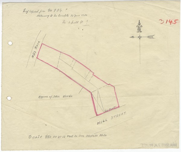
The 1761 Wren Map and the first edition Ordnance Survey map provide even greater detail about the mill race’s origin. It appears to have been a diverted tributary of the Clanrye River, beginning in the area opposite to where the Linen Hall Arch on the Canal Quay is (behind Glin Ree Court) and running diagonally towards bleach mills in the area of Downshire Road Orange Hall. From there, it followed Downshire Road into town, continuing along Trevor Hill. The bleach mills are documented in a 1767 advertisement in the Belfast Newsletter, which describes a facility capable of bleaching 2,000 pieces of linen per season, complete with water supplies, furnaces, drying lofts, and living quarters for workers.
By 1815, Newry Magazine recorded the transformation of the low ground area, (nowadays Hill Street area) with an elderly resident, Charles Havern, recalling when it had been a marshland. He also remembered two bleach greens near what later became the Commercial Coffee Rooms in 1794, now the site of Jack Murphy’s Jewellers and Santander Bank. This area, known as Seymour’s Green, was likely named after a local linen manufacturer. In 1786, William Drennan, a physician who would become a prominent United Irishman, referenced the race in a poem to Miss Courtney, describing it as a picturesque part of Water Street, where “the nightly cascades shall resound in her ear / And the mill race runs by so sweet and so clear.” A future article will deal with the arching over and enclosure of Newry’s mill race.
The Museum is currently offering free tours of the main exhibition galleries on Wednesdays at 2.00 pm. These must be booked in advance by calling their Education Officer at 0330 137 4422.
Newry and Mourne Museum is open Tuesday – Saturday 10.00 am – 4.30 pm. Please call 0330 137 4422 or email museums@nmandd.org for further information.
Visit their website at www.visitmournemountains.co.uk