Write a comment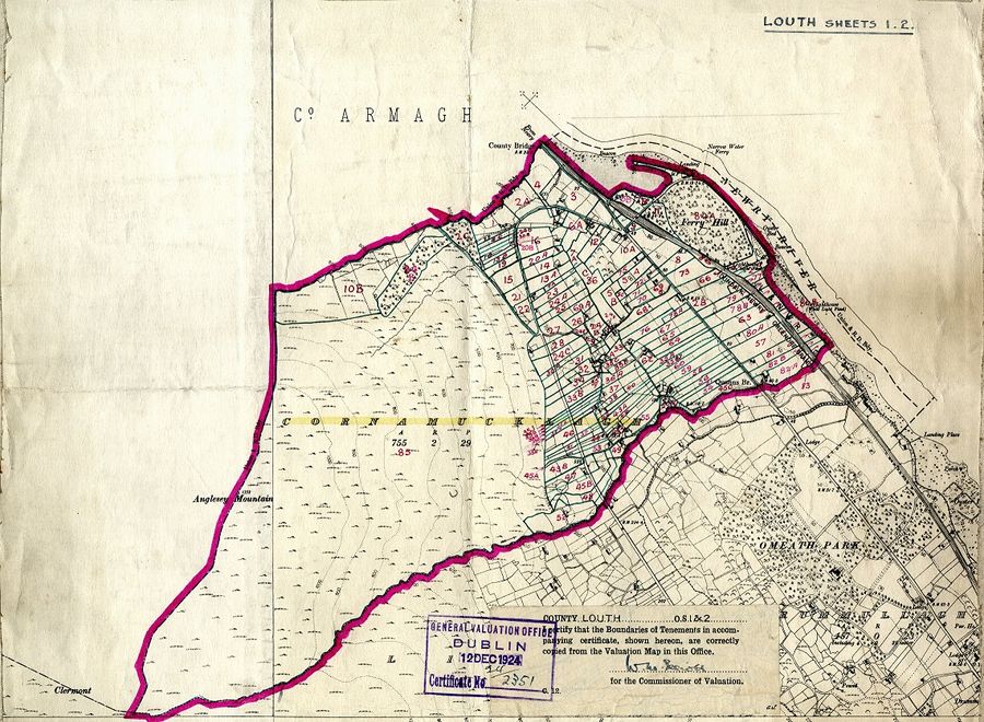
Before the passing of the Government of Ireland Act in 1920 the Irish Land Commission based in Dublin had been handling the sales of holdings to tenant farmers throughout all of Ireland. These had been ongoing since the Land Act of 1903, commonly called the Wyndham Act, but were suspended for the duration of the Great War. Two lots of local sales which had been completed in 1912, before the suspension, were firstly, of more than 2,000 acres to around 130 tenants of the Hall estate in the townlands of Mullaghglass, Cloughrea, Maytown, Derrywilligan, Glassdrummond, Cloughinney, Latt and Goragh and, secondly, of just over 1900 acres to 134 tenants of the Kilmorey estate around the Kilkeel area. (Note: The spelling of townland names in this article is as they appeared in official documents at the time).

When the Northern Ireland Land Commission came into being on 1st April 1923 responsibility for sales on estates within the six counties was transferred to it from Dublin. Among the local sales that had been underway, and the new Commission now took over, were those on the Richardson estate around Bessbrook in the townlands of Clougharaven, Carrickcruppen, Maghernahely, Camlough, Carrickbracken, Cloghgrovla, Cross, Ballard, Keggal, Ballynaleck, Carrickcloughan and Derrymore in 1923, and in 1924, the Hall estate townlands of Aughnamoira, Ballydesland, Ballymaconaghy, Ballyrussell, Burren, Clonallon, Donaghguy, Dromore and Ringmacilroy where the tenants had originally signed agreements to purchase in July 1908.

Whereas in Northern Ireland, sales continued under the terms of the original 1903 Act, in the new Free State the problems were much larger and new laws with compulsory purchase powers and much less generous terms for landlords were quickly passed. From these, in August 1931 around 125 acres were vested by the Land Commission in twenty-three tenants of the Hall estate in Cornamucklagh townland. It was to be 1951 before the vesting to the former tenants was completed.
When the Government of Ireland Act had been drawn up the Westminster government retained responsibility for land sales and, in 1925, after agreement with the Ulster Farmers Union and the landlords’ representatives, it passed the Northern Ireland Land Purchase Act which granted compulsory purchase. On the Kilmorey estate around Newry the beneficiaries of this Act were the 570 tenants in the townlands of Carnbane, Lisdrumgullion, Derrybeg, Ryan, Ballinlare, Gransha, Ouley, Ballyholland Upper and Ballyholland Lower, Ballynacraig, Commons, Fathom Upper, Drumcashellone, Altnaveigh, Cloghoge, Drumalane, Lisdrumliska and Ellisholding where sales from mid-1929 to mid-1930.
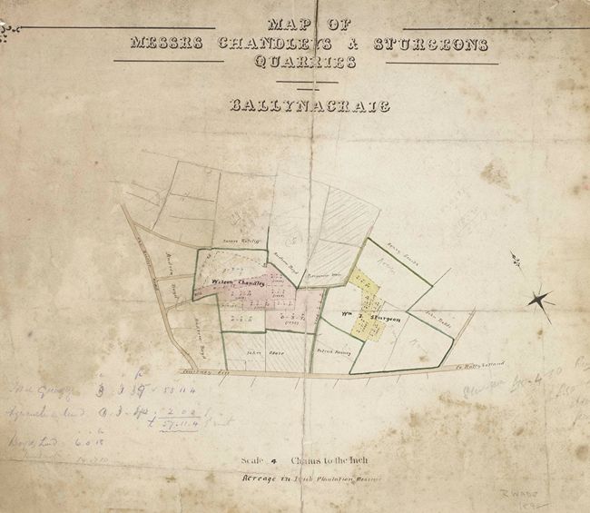
All Land Acts had exclusions to what was vested by the land commissioners. Mineral rights on previously tenanted land were not transferred to the new owners and these rights were either retained by the landlord or by the Land Commission. Quarries were the most common example of this exclusion. Similar also to exclusions in earlier land sales the 1925 Act excluded holdings that were not primarily agricultural or pastoral land or were holdings where the occupier worked on the landlord’s own estate. Lands that had potential for building, mostly near towns and villages, as well as town parks which were plots of land rented from the landlord by town dwellers, were also excluded from sale. In July 1930 the renters of thirty-two holdings from the Hall Estate around Warrenpoint brought a legal challenge against the exclusions of their plots from the sale but all their appeals were dismissed and costs, with one exception, were awarded against them.
When the Northern Ireland Land Purchase Commission was wound up in 1935 and its powers transferred to the Ministry of Finance it had overseen the transfer of more than 800,000 acres to 38,500 tenants.
Documents relating to the work of the Irish Land Commission and the Northern Ireland Land Commission are on display in the Newry and Mourne Museum’s temporary exhibition, The Legacy: Newry 1920 – 1930, which explores the impact of Partition on the Newry and Mourne area.
John Corrigan is a retired BT engineer and is a Volunteer at Newry and Mourne Museum. He recently completed an MA in Irish History at Queen’s University Belfast. His dissertation looked at the impact of the Irish Land Commission on the estates of the Hall family.
The Museum is currently offering free tours of the exhibition galleries on Wednesdays and Thursdays at 11.00 am. These must be booked in advance by calling our Education Officer at 0330 137 4422.
Newry and Mourne Museum is open Tuesday – Saturday 10.00 am – 4.30 pm. Please call 0330 137 4422 or email museum@nmandd.org for further information.
by John Corrigan